
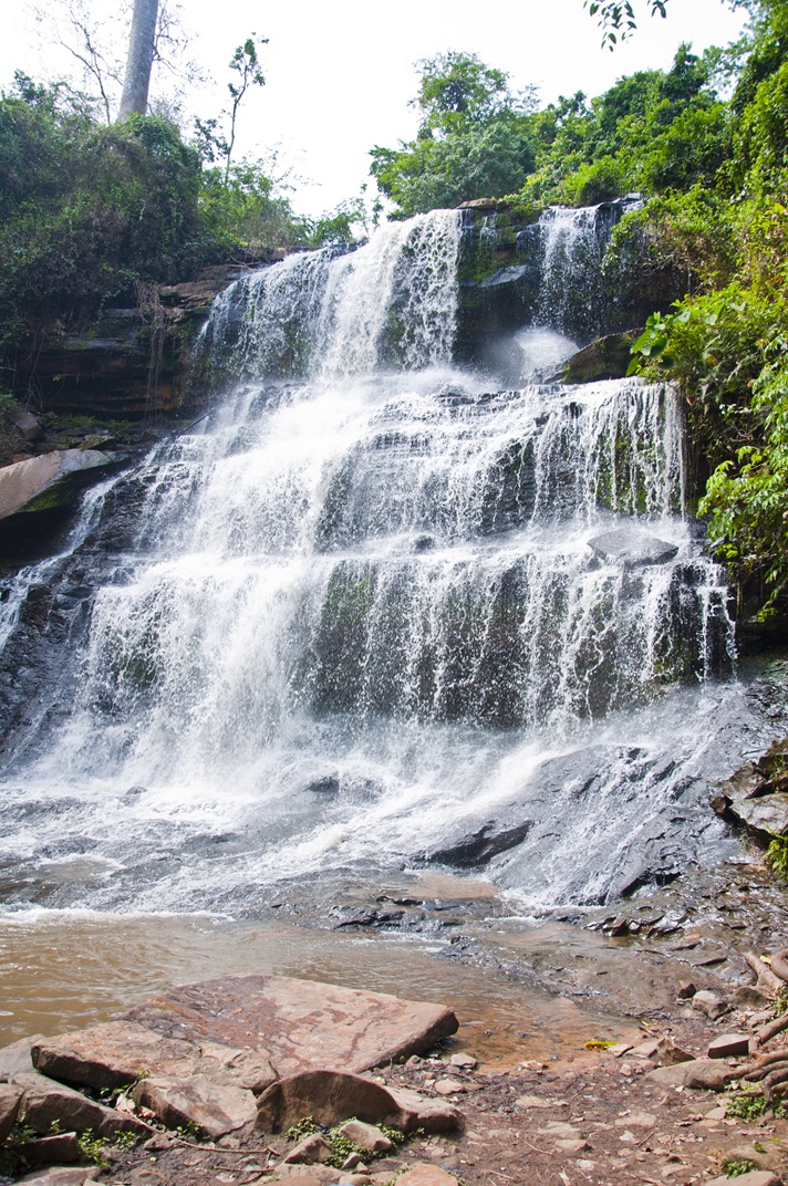
Kintampo Waterfalls
Kintampo, Bono East
A three-stage waterfall on the Pumpum River a short distance north of Kintampo town.
Wikipdedia
Visiting information
- Address
- Kintampo - Bono East Region.
- Opening information
- Open 8:00 AM to 5:30 PM daily, Monday through Sunday.
- Accessibility
- Accessibility information has not been verified for this place.
- Suggested time
- The best time to visit Kintampo Waterfalls is during the rainy season, from June to October.
About this place
The Kintampo Waterfalls fall in three main drops, the longest about 25 metres, over a total descent of roughly 70 metres on the Pumpum River, a tributary of the Black Volta. The falls lie in forested terrain about four kilometres north of Kintampo and were known during the colonial period as Sanders Falls. The site is maintained for visitors and includes a canopy walkway.
District profile
Kintampo
Kintampo is the seat of the Kintampo Municipal District in the Bono East Region.
Why stay here: Kintampo is the base for the region's two best known waterfalls.
Atmosphere: A junction town in Ghana's transitional forest belt, surrounded by rivers and waterfalls.
Kintampo sits on the main road north from Techiman toward Tamale.
Nearby attractions
More to explore around Kintampo and the wider Bono East.
 Fuller Falls YabrasoA series of cascades on the Oyoko River at Yabraso, west of Kintampo. The best time to visit Fuller Falls (and waterfalls in Ghana generally) is during or immediately after the main rainy season, specifically from July to November.
 Boabeng-Fiema Monkey Sanctuary BoabengA sacred forest between the villages of Boabeng and Fiema where colobus and mona monkeys are protected by custom. The best time to visit the Boabeng-Fiema Monkey Sanctuary is during the dry season from November to April, specifically in the early mornings or late afternoons when the monkeys are most active.
 Buoyem Caves and Sacred Grove BuoyemA sacred grove and cave system near Buoyem village sheltering a large colony of cave-roosting fruit bats. Buoyem welcomes visitors year-round. It has two rainy seasons – March through July and September through November – during which rain gear is recommended, and rock scrambling may be slippery..
Recommended district
Kintampo
Kintampo is the base for the region's two best known waterfalls.
Plan the rest of your visit
Build an itinerary around this district, or check what Ghana requires for entry before you travel.
Sources and verification
Status: Verified. Last reviewed 2026-09-07.
Graphic Online, Bono East tourismVisitAfrica publishes discovery and cultural information. We do not sell tickets, tours or accommodation, and we do not publish prices or ratings.